
Forecasters say some drier days on the horizon (maybe)
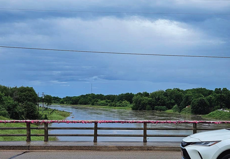
With reports of four or more inches of rain falling over much of an already drenched Lavaca County Saturday, creeks quickly rose that morning, covering several roadways beneath fast-moving flood waters
Much of Lavaca County remained under flash flood warning from about 4 a.m. to 2 p.m. Saturday, May 13. Then, just as quickly as those waters rose, the county’s creeks and drainage systems swiftly carried it on down toward the bay, which is precisely what they should do.
The newspaper ran into Hallettsville Councilwoman Chastity Grant Carter out checking the waters after the final round of heaviest rains finally eased on Saturday afternoon. “Looks like Hallettsville got through it all just fine,” she said.
The rains are expected back, however. Forecasts are saying the rain chances could hang on in the area until as late as Wednesday before the sun starts drying the county out once more. And as many were quick to point out.
Residents are asked to exercise caution at all low-lying areas over the next few days.
The safest bet is to wait out any areas where water has covered the road.
Not only are those currents far more powerful than they appear, they may have - as early reports indicated did happen Saturday, near Cuero - fast moving flood waters also may have compromised a culvert or the very roadway itself
The safest option is also really the simplest: Turn around, and do not drown...